Florida Back Roads: The House of Refuge

Florida Back Roads: The House of Refuge

People ask me why I fight so hard for our life here in Martin County. It’s because we are different. Yes, there has been some changes since I moved here and there are some things coming I’m not ok with but for the most part the people who live here really care about our county and our way of life.

This is one of the first places I visited when I moved here.

house-of-refuge-stuart-florida-cyndi-lenzDSC_0066

The House of Refuge at Gilbert’s Bar is the only remaining House of Refuge. It was built as one of ten along the east coast of Florida, it is the oldest structure in Martin County and is listed on the National Register of Historic Places.

The Houses of Refuge were designated as havens for shipwrecked sailors and travelers along the sparsely populated Atlantic coastline of Florida. Run by the United States Lifesaving Service, the Houses played a critical role in a time when sailing ships dominated the world commerce.

This week we have big waves and big tides. We had the full blood moon and we have Hurricane Joaquin out there.

Yesterday was the first gorgeous day after a long, hot summer so I went down and took some photos.

DSC_0054 DSC_0050 DSC_0020 DSC_0008

The House of Refuge is located at 301 Southeast MacArthur Blvd, Stuart, FL

houseofrefuge

Florida Back Roads: Yesterday’s Woad Twip , The Peace River and oh ya pollution.

Yesterday, I drove over to Sarasota to see my family and go to a party. It was a pretty special day. Two birthdays and we would find out a baby gender. I decided to take Barney because there would be a fenced in back yard and it’s cool enough if you leave early in the morning for him to be in the car.

Even though there is so much to talk about, think about and write about we have to remember why we are here in the first place.

It’s a great ride.

We started off in Jensen Beach from our little house on the hill and this glorious sunrise.

sunrisejensenbeach

Here is Barney my almost 18 year old golden. There’s nothing he loves more than a “Woad Twip.”

barneysarasota

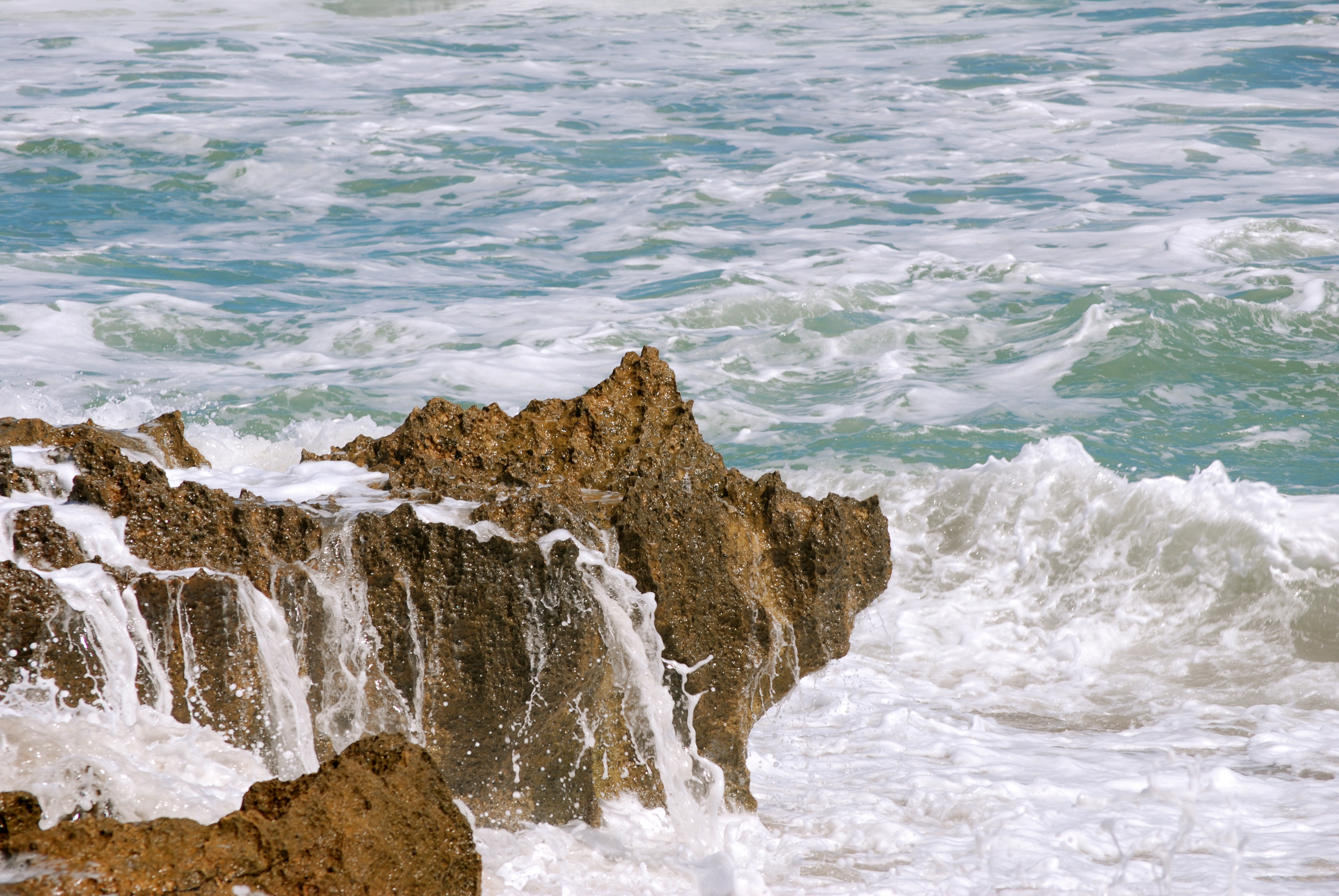
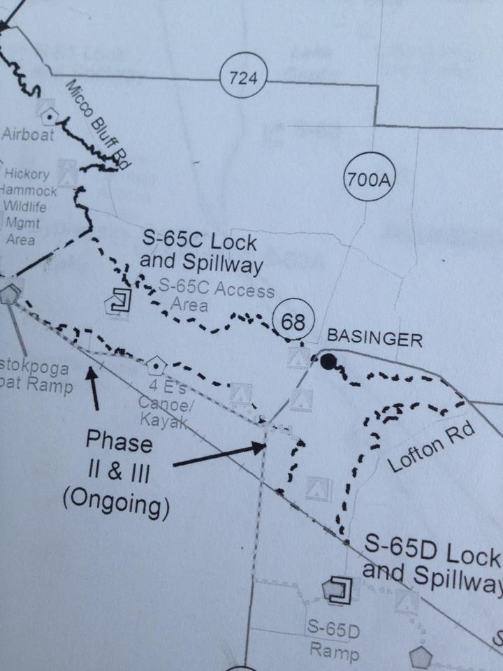
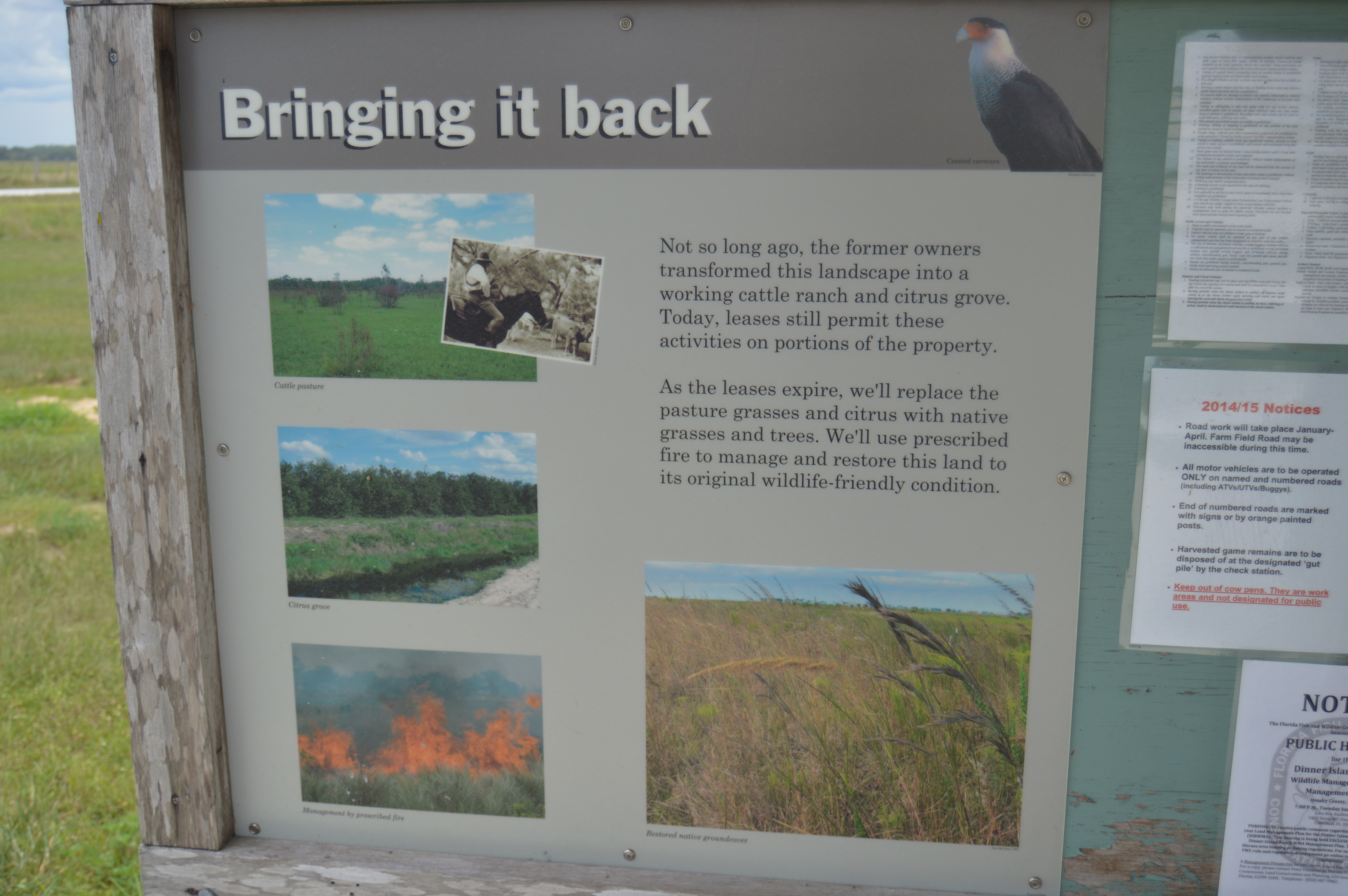
Here’s the fog out at fog  at Alapattah Flats Management Area. I’m still in Martin County.

fogalflats

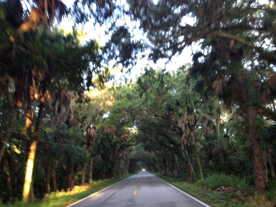
Here is our Martin Grade Scenic Hwy. It’s fabulous and worth the ride. The best ride would be coming from the west early in the morning because the light is amazing. Make sure you have a driver because there is no place to stop.  I looked behind me as I drove and it was like the light was following me down the road.

martingradescenichwy

The end of this road is the end of Martin County.

Through Okeechobee, Highland County and onto Desoto County which has a grand sign about tranquility and prosperity and something else I can’t remember.

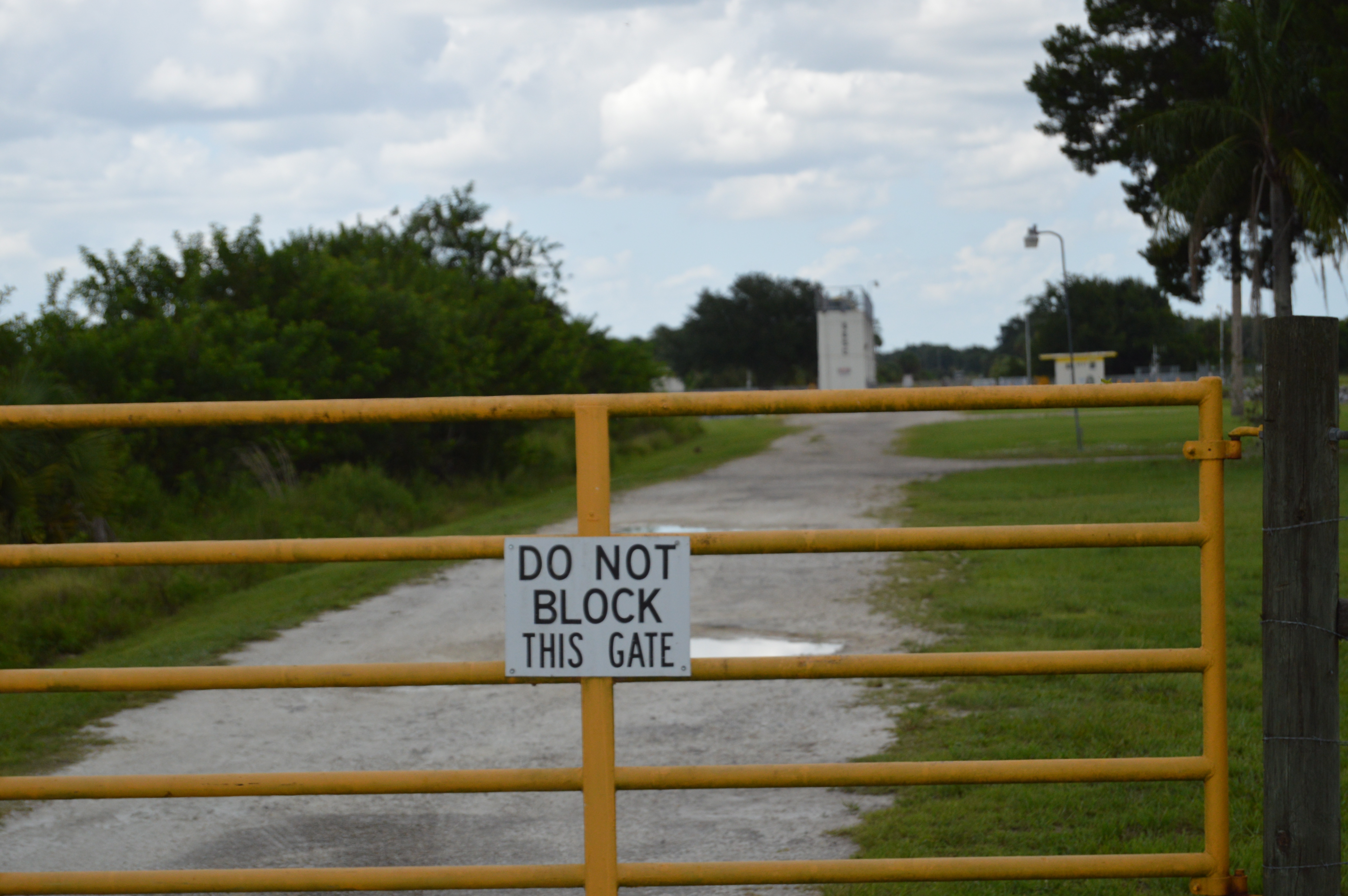
I had to stop. The main reason was I really needed a bathroom and it’s very hard when you travel alone with a dog to find a place you can just run into and safely leave your dog in the car with the windows down. Barney barks not when you come towards him but when you leave. I’m sure if we were ever robbed he would bark as the robber’s were leaving  abandoning him. “Come back. Don’t leave me!”

Just an interesting note. In Arcadia, FL the streets are names for the Florida Counties. I’ve stopped there a few times and I really need to go back and I think it would a fun place to meet the kids in the future.

Check it out.

Arcadia is famous throughout Florida for its historic downtown antique district. Additionally, on the fourth Saturday of each month, vendors from surrounding locations take over our streets with even more wares and precious finds. Tucked between the shops, you’ll have the chance to enjoy cafés, home cooking, a tea room and even an old fashion ice cream parlor, complete with homemade delicious flavors, sundaes and shakes.

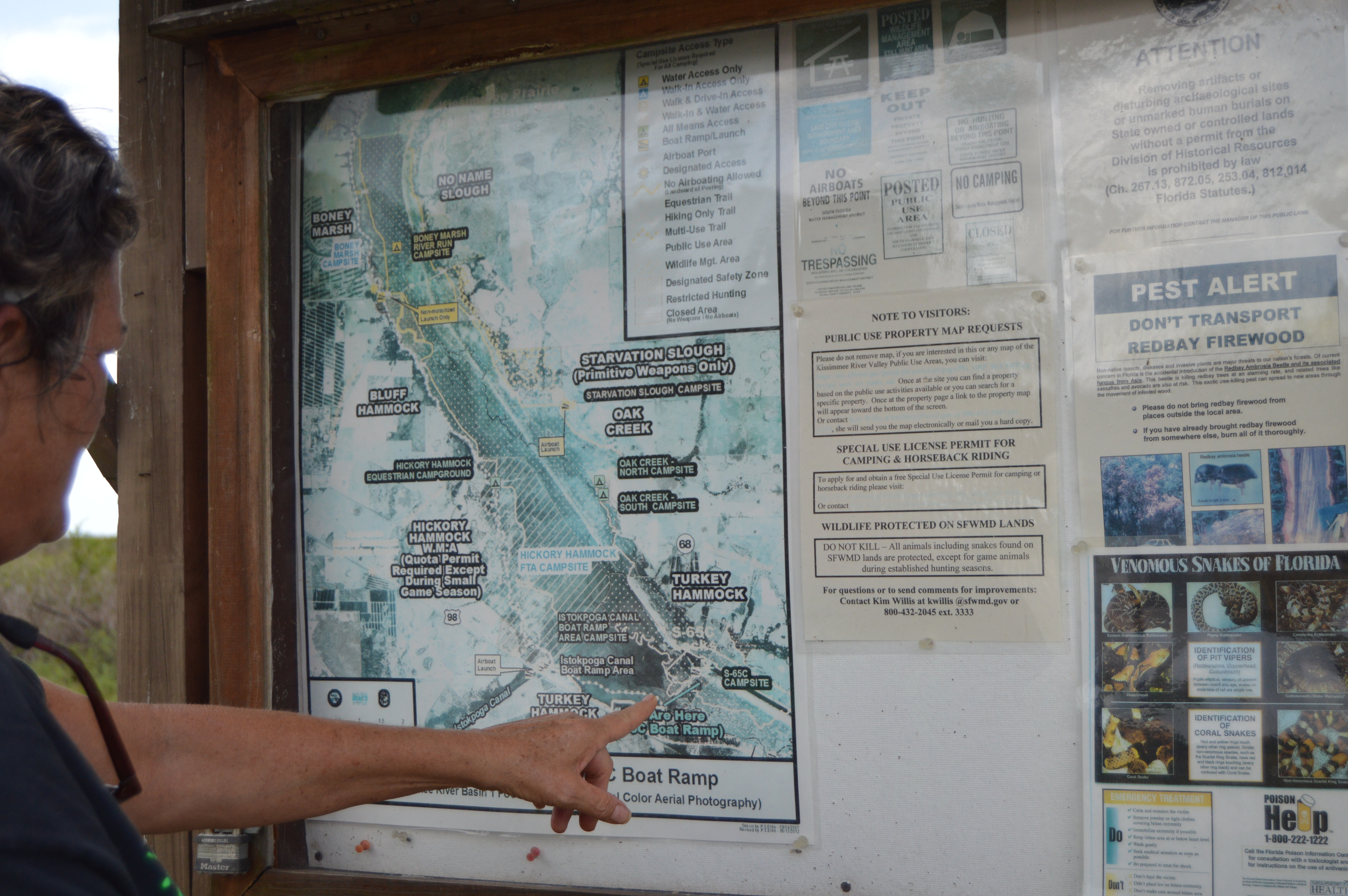
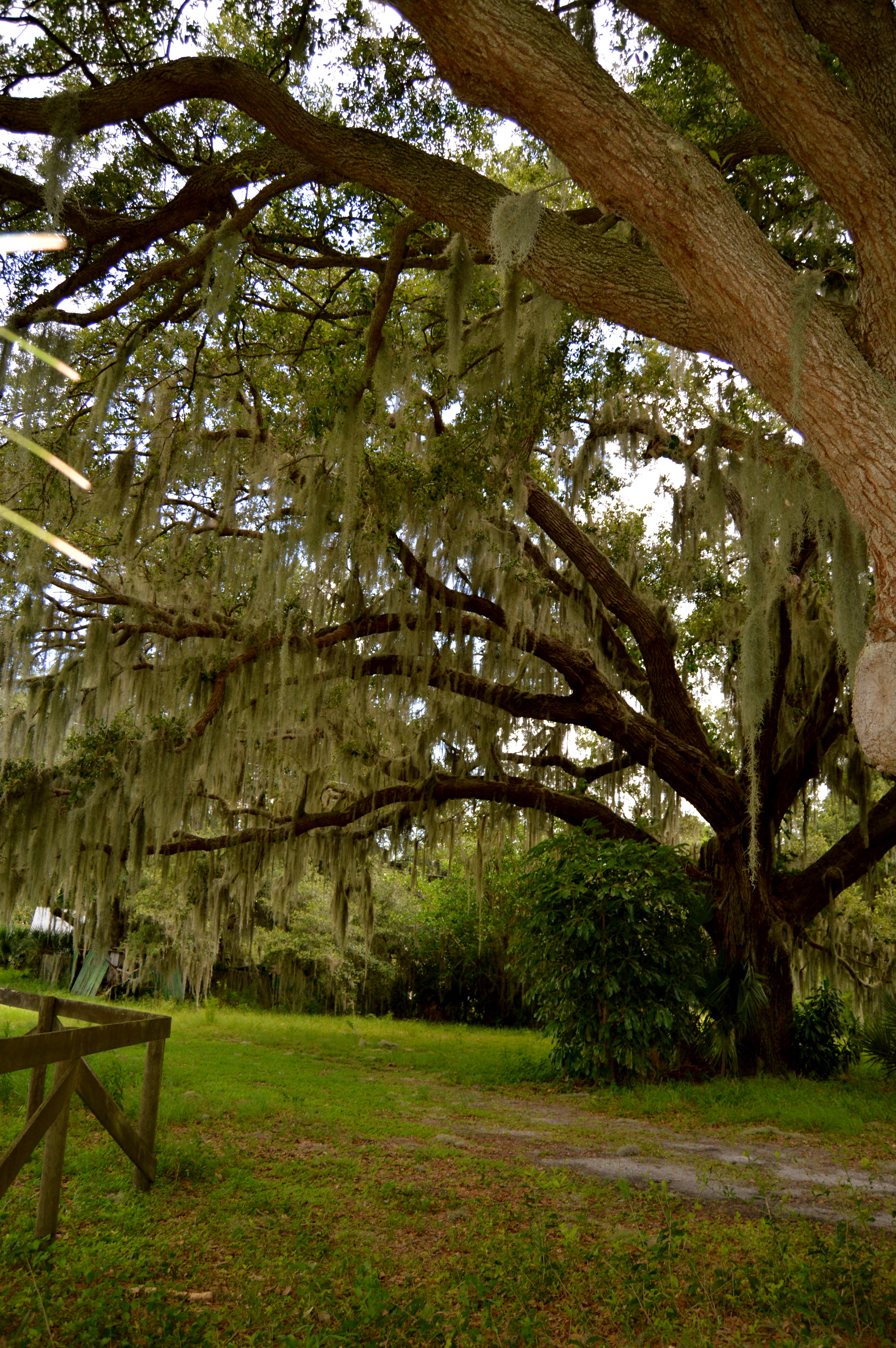
The second reason was I wized past this place so many times I just wanted to see what it was and take Barney for a little walk and shoot some photos.

Across the road there were guns going off. Hundreds of cars and people shooting guns and a big no trespassing sign.

This is where we went.

http://www.desotobocc.com/department/parks_recreation/desoto-veterans-memorial-park

DeSoto Veterans Memorial Park

2195 NW American Legion Dr Arcadia, FL 34266

“With boat ramp and picnic areas, this park is used frequently by groups and large gatherings such as Pioneer Days and Relay for Life. With the shade provided by the large oak trees, this is the perfect place to park and enjoy your lunch hour. This park also features restroom facilities.”

When traveling in Florida you always to leave a little early because there’s always someplace to stop with your dog and take a moment to breath and use the rest room.

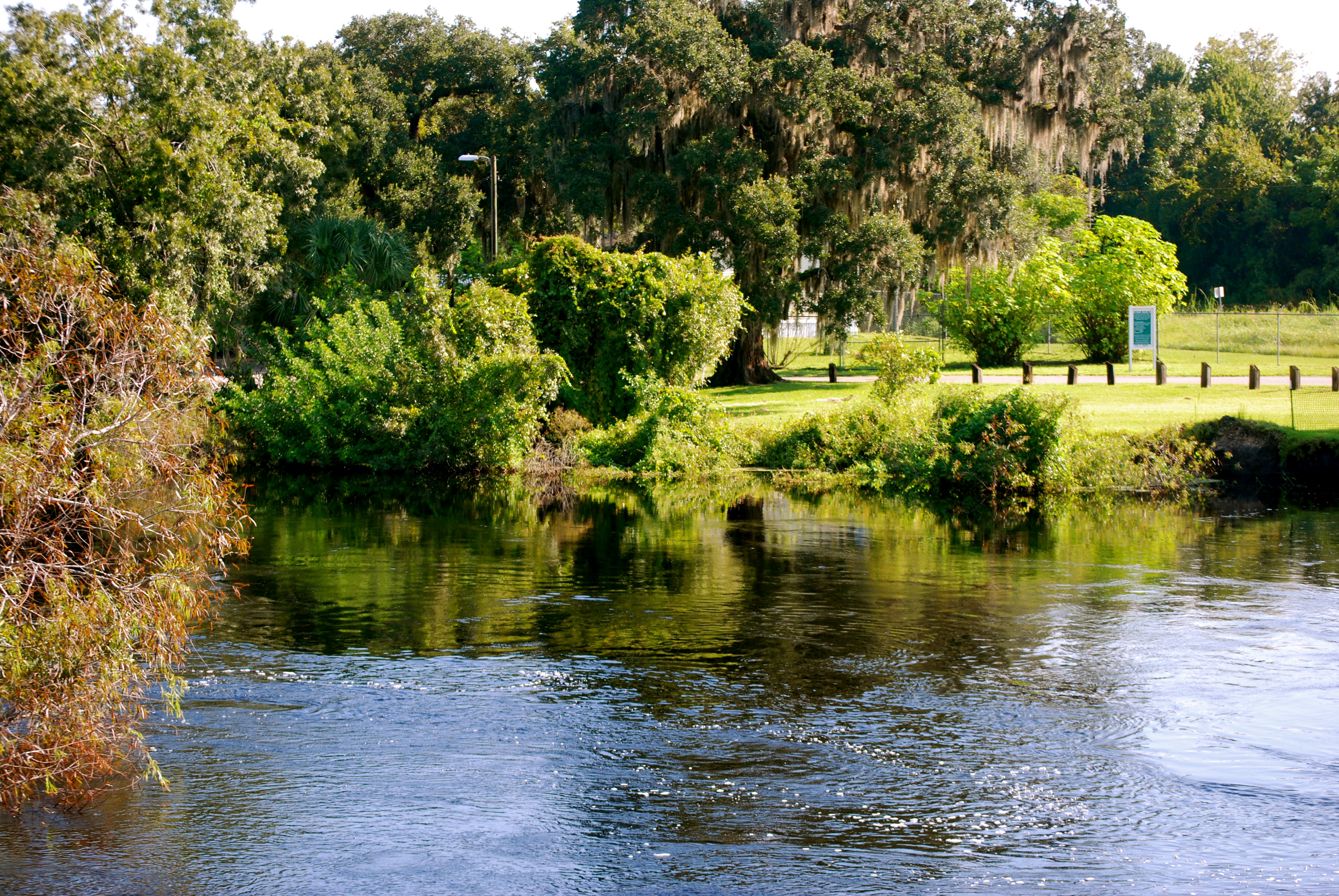
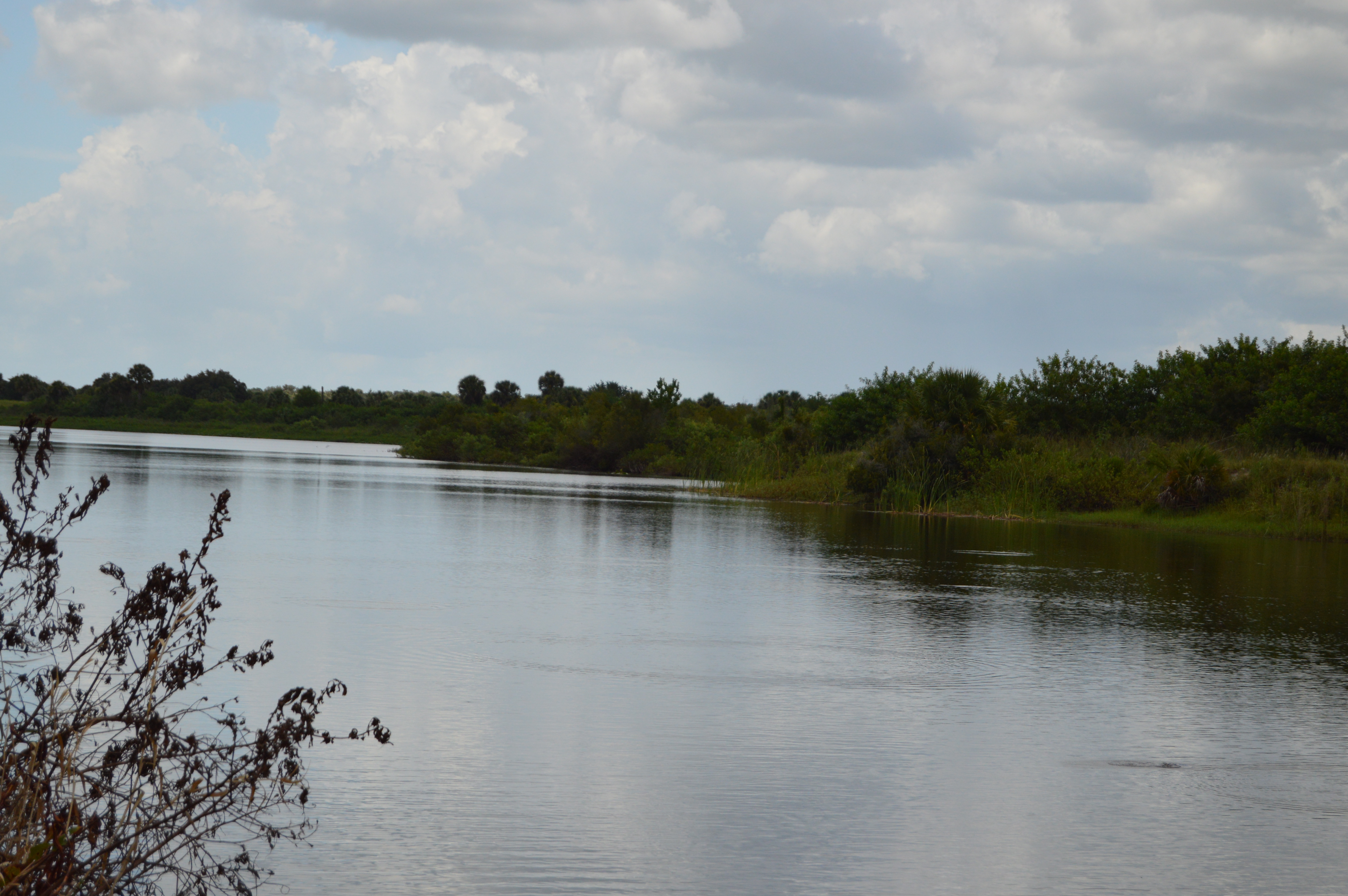
Here is the Peace RIver.

https://en.wikipedia.org/wiki/Peace_River_%28Florida%29

From Wikipedia, the free encyclopedia (photos are mine)
DSC_0031

The Peace River is a river in the southwestern part of the Florida peninsula, in the U.S.A. It originates at the juncture of Saddle Creek and Peace Creek northeast of Bartow in Polk County and flows south through Hardee County to Arcadia in DeSoto County

DSC_0029

and then southwest into the Charlotte Harbor estuary at Port Charlotte in Charlotte County. It is 106 miles (171 km) long and has a drainage basin of 1,367 square miles (3,540 km2). U.S. Highway 17 runs near and somewhat parallel to the river for much of its course. The river was called Rio de la Paz (River of Peace) on 16th century Spanish charts. It appeared as Peas Creek or Pease Creek on later maps. The Creek (and later, Seminole) Indians call it Talakchopcohatchee, River of Long Peas.[3] Other cities along the Peace River include Fort Meade, Wauchula and Zolfo Springs.

DSC_0028

Fresh water from the Peace River is vital to maintain the delicate salinity of Charlotte Harbor that hosts several endangered species, as well as commercial and recreational harvests of shrimp, crabs, and fish. The river has always been a vital resource to the people in its watershed. Historically, the abundant fishery and wildlife of Charlotte Harbor supported large populations of people of the Caloosahatchee culture (in early historic times, the Calusa). Today, the Peace River supplies over six million gallons per day of drinking water to the people in the region. The river is also popular for canoeing.[5]

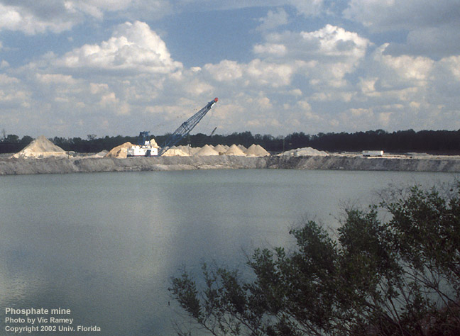
There were many Pleistocene and Miocene fossils found throughout the Peace River area, eventually leading to the discovery of phosphate deposits. Most of the northern watershed of the Peace River comprises an area known as the Bone Valley.

The Peace River is a popular destination for fossil hunters who dig and sift the river gravel for fossilized shark teeth and prehistoric mammal bones. Several campgrounds and canoe rental operations cater to fossil hunters, with Wauchula, Zolfo Springs, and Arcadia being the main points of entry.

http://www.protectingourwater.org/watersheds/map/sarasota_bay_peace_myakka/peace/

A number of major restoration activities are under way in the watershed, particularly in the Peace River region. The objectives of the SWFWMD’s Upper Peace River Watershed Restoration Initiative include the restoration of surface water storage and flows and aquifer recharge, as well as improvement to water quality and ecosystems that have been lost, degraded, or significantly altered. The initiative will provide a critical link to a major greenway that extends from Florida’s lower west coast up through the Peace River watershed and Green Swamp, and north to the Ocala National Forest. Projects undertaken through the initiative involve Lake Hancock, the upper Peace River, and the Peace Creek Canal.

Why can’t I just write a blog about the great things in Florida.

swaremoval

THREAT: PHOSPHATE MINING
HUGE PHOSPHATE MINES ARE DEVOURING THE PEACE RIVER WATERSHED, LEAVING BEHIND UNSTABLE CLAY POOLS THAT PREVENT WATER FROM REACHING THE RIVER — UNTIL THEY COLLAPSE.

Peace River Makes the 2004 Most Endangered Rivers List

Florida – America’s rivers and streams are becoming more polluted — and the White House and Congress are making a bad situation worse by cutting clean water law enforcement and spending on pollution prevention, charged American Rivers with the release of its 2004 Most Endangered Rivers report.

* On President Bush’s watch, EPA is issuing less than half as many “violation notices” to polluters who break the law, and is levying smaller fines, as well

* One-fourth of America’s largest industrial and sewage treatment plants are in “significant noncompliance” with water pollution standards at any one time

* The White House and Congress have declined to reauthorize the Superfund tax to ensure that polluters pay to cleanup toxic waste instead of the taxpayers

* On his first day in office, President Bush scrapped a proposal to require wastewater treatment plants to notify the public when the spill sewage into streams and rivers.

* In November 2003, the EPA proposed to sanction dumping fully and partially treated sewage into rivers when it rains.

* The federal government used to pay 20% of water infrastructure costs. Now it pays 5% and President Bush has asked the Congress to cut this by another third for 2005.

* Removed restrictions that protect streams from mountaintop removal coal mining

* Issued new nationwide permits for building shopping centers, tract housing, and corporate campuses on top of wetlands and flood-prone areas

* Discouraged federal field staff from protecting many wetlands and streams under the Clean Water Act.

* 51% of the mouths of America’s rivers were designated “impaired” in 2000, up from 37% in 1994

* EPA estimates that sanitary sewers overflow directly into streams, lakes, and estuaries 40,000 times and that as many as 3.5 million American get sick from swimming in water laced with sewage each year.

* Forty-three states have issued fish-consumption advisories along 500,000 miles of river

* The United States loses 60,000 acres of wetlands each year – increasing the frequency and severity of floods

Summary
Phosphate mining in the Peace River watershed has been the source of serious environmental problems for many years, and large new mines are planned. Florida’s Department of Environmental Protection (DEP) and the Southwest Florida Water Management District (SWFWMD) must take measures to safeguard the river and communities in the watershed from mining impacts, including protecting drinking water, and important tourism and commercial fishing industries.

I have to do more research. If any of you guys have any more info email me at clenz@mac.com.

Someone Save Pahokee’s Old Prince Theater! Former Mayor was too busy obsessing.

 Someone Save Pahokee’s Old Prince Theater! Former Mayor was too busy obsessing.

When I lived in Palm Beach County Pahokee was that place way out there. I don’t even think when I worked in home health from Boca I ever went out there. It’s pretty torn up. Yet the people that live there are so nice. Real people. I’d rather spend a day in Pahokee than a day in Palm Beach. Truly.

I feel like the whole area are the forgotten people but whats so funny is they haven’t forgotten themselves. They just go on with their day. This is their life.

DSC_0070

So if you go to downtown Pahokee you see this: An old movie theater and the base is made from coral.

Here is some info about the “Prince Theater.”

http://cinematreasures.org/theaters/26826/comments

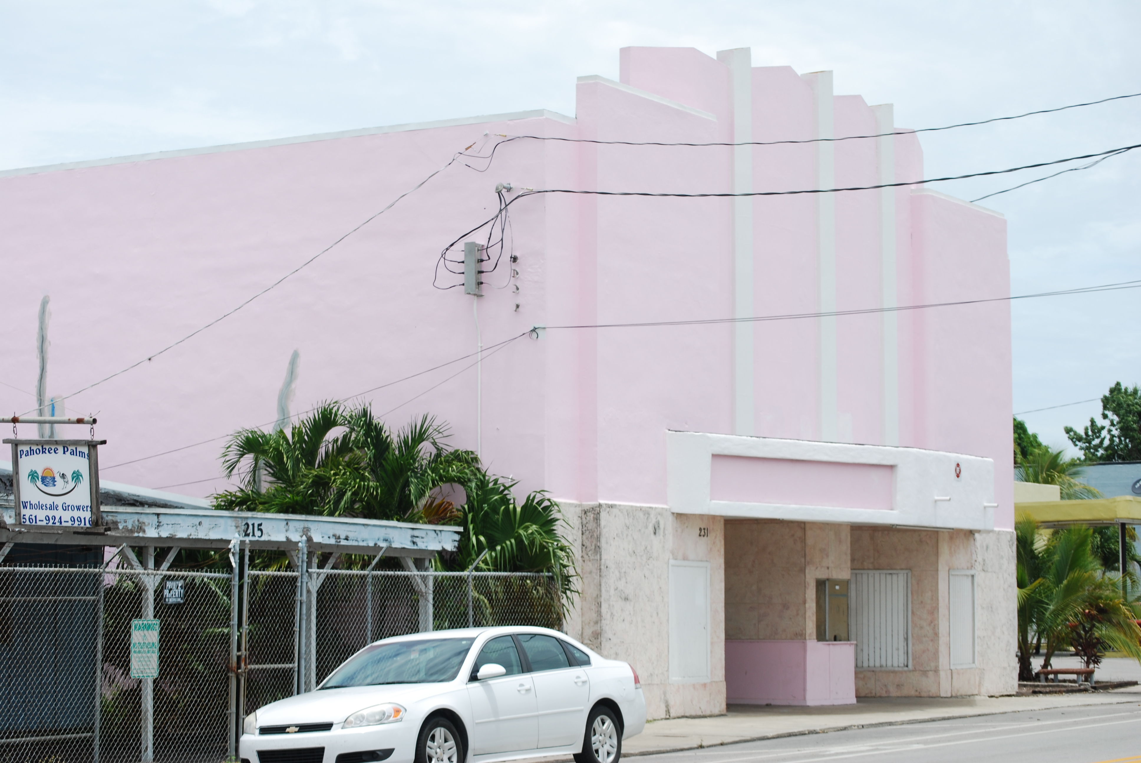
Joe Vogel on April 4, 2015 at 4:40 amThe original Prince Theatre was replaced in 1940. The April 5, 1940, issue of The Film Daily had this item:

“Dobrow to Erect New Theater Building, Refurnish Another“Pahokee, Fla. — A call for bids is being made by Abe Dobrow of the Everglades and Prince Theaters, for a new structure to replace the present building housing the Prince theater. Bids will be opened April 8. Plans also call for complete refurnishing of the Everglades theater.”

This follow-up item is from the January 3, 1941, issue of The Film Daily:

“Open New Pahokee House“Pahokee, Fla. — New $40,000 Prince theater, has been opened. The 600-seater is owned and operated by Gold & Dobrow. Don Hiller & Sons, Pahokee, were the contractors.”

Listings of the Prince Theatre in FDY’s from the 1930s consistently give it a capacity of 250, so it was less than half the size of the new house. It seems unlikely that the original Prince Theatre would have been demolished in 1940 if its building was only nine years old, so it’s likely that it was either an older theater that had operated under a different name earlier in its history, or it was in an older commercial building that had been converted into a theater in 1931.Architect Chester A. Cone was still in practice at least as late as 1985, so it seems likely that it was the 1940 rebuilding of the Prince Theatre that he designed, rather than the original house.

In 1966, the Gold-Dobrow chain leased three of their five theaters, including the Prince, to a Miami-based chain. An article about the transfer in the December 21 issue of The Palm Beach Post said that the Gold-Dobrow chain had been “…organized about 35 years ago….” That would be consistent with the 1931 opening of the original Prince Theatre, whether it was a new operation or an old house renamed by the new owners.

DSC_0101 DSC_0098 DSC_0095 DSC_0094

http://www.palmbeachpost.com/news/news/pahokee-sues-business-owner-demands-teardown-of-th/nL9xX/

From 2010:

“A fight is brewing over the crumbling, pink Prince Theater on Main Street, where country music singer Mel Tillis got his start and Glades children spent countless Saturday afternoons.

But city leaders aren’t fighting to restore the 70-year-old landmark. They want to force its new owner to tear it down.

The city sold the theater to businessman Emilio Perez for $8,500 on March 1, with the understanding he would demolish the building and use the site to expand a gas station for economic development. Now the city is suing Perez for breach of contract after he started to repair the building instead.

“The bottom line is: ‘Just do what you said you would do,'” Mayor J.P Sasser said. “All we want him to do is honor his original agreement.”

In a June 29 letter to the city, Perez said he had a change of heart about demolishing the theater after residents asked him to fix and re-open it.

The 500-seat theater was built in 1940 and showed first-run movies and live performances for about 25 years until it closed in the mid-1960s. Tillis, who grew up in Pahokee, said he got his start singing at talent shows at the Prince Theater in the late 1940s

The theater sat dormant for more than a decade, and its owners donated it to the city in 1976. After residents led by Harriet Seldes raised more than $100,000 to renovate the building, it reopened in 1980 for community events and later for movies.

“We were doing this not only for the adults in the community but also the children,” said Seldes, who now lives in Port St. Lucie. “There was no other theater, nothing else for children to do but football.”

The theater closed again after a few years. Tropical Storm Fay in 2008 damaged the roof so badly that city officials decided it was beyond hope of repair, Sasser said.

Pahokee resident Larry Wright said the Prince should not be torn down. He suggested that a nonprofit theater group could be organized to put on plays there using local children.

Sasser said that before being elected this year he had worked with a group that tried to find money to save the Prince, but it was a lost cause because of the extent of roof damage and other needed repairs.”

Seriously JP you spend too much time obsessing about the septic tanks in Martin County to pay attention to your own town the wonderful place it could be. You could find a roof company and try to raise the money to fix this. You want it replaced with a Gas station?

You could fix this place out. Have a children’s theater. Show some good movies. Have some concerts. Who would want to demolish such a gem. You could have brought people to pahokee!

We need to help Pahokee!

Maybe someone from the Island of Palm Beach could invest in this. It would be awesome. We need to invest in the children of Pahokee.

Pahokee out by Lake O. Forgotton building could be something wonderful.

Pahokee out by Lake O.
Forgotton building could be something wonderful.

Hopefully the new mayor will fix this place up!

DSC_0082 DSC_0076

http://florida.newszap.com/belleglade/121121-113/walkes-named-new-pahokee-mayor

“Sasser has been one of the most visible representatives of the Pahokee area on the state and federal level, taking trips to Tallahassee and Washington D.C. to argue his case for his hometown and for the Glades area. Along those same lines, it was his sharp tongue and his haranguing of other elected officials that landed him in the headlines. Sasser defended the area in a distinct way, and a harsh scolding of the county or state was one of the many cards Sasser played to get his message across.

With a convincing loss to a political newcomer, Sasser said his political career in Pahokee in over.”

Oh Goody!  The water issue has got to be fixed! But looking at the old Prince theater which is a jewel that you want to tear down instead of putting effort into having something for the children of your town is beyond me. Good for the guy who bought  it and changed his mind.

http://www.sunshinestatenews.com/story/former-pahokee-mayor-dont-let-lake-o-flood-us

JP Sasser’s belief that we want to flood out Pahokee.

“He said, “The first thing Senator Negron did was to sit me down and assure me that nobody wants to flood Pahokee. I told him, ‘Oh, yes, they do. They want all the lake water flowing south. Do that and we’re done.'”
It’s very hard to deal with someone who has their own belief system and just won’t listen. I wrote this a while back. I’m so sick of rehashing this point. But you can watch the Sugarland Video and see that we all sincerely wanted to work together and it was the people that lived out on the Lake that started this whole ‘They want to flood us out thing.” I know where it came from.. That’s not what was said. You all are still in danger.
I know where it came from.. That’s not what was said. You all are still in danger. And no you can’t build giant cities out there with new Walmarts. Because you can’t have it both ways. We discharges to protect you guys. No one in their right is going to put anyone else in danger.
No one wanted to flood them out. This is just Big Sugar BS for lets change the subject and make all those tree hugging liberals look bad.
metree

yes this is me hugging a tree.

No one wanted to flood you out JP. We wanted you to do your job and take care of the people of Pahokee. If you weren’t so obsessed with us perhaps you could have done that.
Now JP is suing the River’s Coalition.
It’s so absurd that I can’t post parts of the article. I read it and laughed.  Seriously are you kidding me?
Why not take the money your spending on lawyers and fix the Prince theater and ask some famous local actor to come out there and have a program for the children you were supposed to represent.
Here is the new mayor of Pahokee!
Glad to see a new face and hope to see some good changes out there.
This is what the people want. I know this because I saw it painted on their store fronts.
DSC_0070 DSC_0073 DSC_0068
 Let’s all be aware of what is going on in Pahokee and perhaps the people of Palm Beach County which has a population of 1,397,710 – If each person sent one buck they could save the prince theater and there would be money left over to do something else for the kids out there.

Florida Back Roads: Kissimmee River Restoration

Florida Back Roads: Kissimmee River Restoration

Ever since I’ve been involved with water issues I’ve heard about the restoration of the Kissimmee River.

https://en.wikipedia.org/wiki/Kissimmee_River

The Kissimmee River arises in Osceola County as the outflow from East Lake Tohopekaliga, passing through Lake Tohopekaliga, Lake Cypress, Lake Hatchineha and Lake Kissimmee. Below Lake Kissimmee, the river forms the boundary between Osceola County and Polk County, between Highlands County and Okeechobee County, and between Glades County and Okeechobee County before it flows into Lake Okeechobee. The river was originally 134 miles (216 km) in length, 103 miles (166 km) of which was between Lake Kissimmee and Lake Okeechobee. It forms the headwaters of the Kissimmee River-Lake Okeechobee-Everglades ecosystem.

The Kissimmee River watershed of 3,000 square miles (7,800 km2) is adjacent to the Eastern Continental Divide, with triple watershed points at the Miami (north), Withlacoochee (northwest), and Peace (west) rivers’ watersheds and the Lake Okeechobee watershed (southwest).The floodplain of the river supports a diverse community of waterfowl, wading birds, fish, and other wildlife.

Every time I drove out there all I saw was this.

DSC_0094

Kissimmee River at Basinger

and this

DSC_0088

Kissimmee River looking north at Basinger

I was always whizzing through and  I never took the time to stop and explore.

It took us a while to find what we were looking for.

http://www.sfwmd.gov/portal/page/portal/xweb%20protecting%20and%20restoring/kissimmee%20river

“The Kissimmee Basin encompasses more than two dozen lakes in the Kissimmee Chain of Lakes (KCOL), their tributary streams and associated marshes and the Kissimmee River and floodplain. The basin forms the headwaters of Lake Okeechobee and the Everglades; together they comprise the Kissimmee-Okeechobee-Everglades (KOE) system. In the 1960s, the Central and Southern Florida Flood Control (C&SF) Project modified the native KOE system extensively throughout South Florida, including construction of canals and water control structures to achieve flood control in the Upper and Lower Kissimmee basins.

Major initiatives in the Kissimmee Basin are the Kissimmee River Restoration Project (which includes Construction Projects), the Kissimmee River Restoration Evaluation Program, the Kissimmee Basin Modeling and Operations Study and the Kissimmee Chain of Lakes Long-Term Management Plan. A number of activities are associated with these projects, including ecosystem restoration, evaluation of restoration efforts, aquatic plant management, land management, water quality improvement and water supply planning.”

We ended up here.

DSC_0024 DSC_0022

Whoops.

Then we ended up here .

11390018_10206486755984097_7255714453957998372_n

It was one of those “It’s got to be here somewhere!”

Then we found this

DSC_0057

You are here!

DSC_0059 DSC_0063 DSC_0070 DSC_0074

We were disappointed that you could not walk out on the lock.

and a little down the road heading south you can put in with your canoes or kayaks.

So this was great right!

http://www.protectingourwater.org/watersheds/map/kissimmee_river/

“The very northern end of the Kissimmee River Basin is primarily urban and includes a small portion of the city of Orlando, three large theme parks (Walt Disney World, SeaWorld, and Universal Studios), Orlando International Airport, and the cities of Kissimmee and St. Cloud. There are some pockets of residential development along the Lake Wales Ridge (in the cities of Lake Wales, Avon Park, Sebring, and Lake Placid) and a military installation (Avon Park Air Force Range). However, agricultural lands (citrus groves, cattle ranches, caladium fields, and sod farms) as well as wetlands and upland forests dominate the remainder of the Kissimmee River Basin and all of the Fisheating Creek Basin.”

So every time someone flushes a toilet at Mickey’s a seahorse dies in the Indian RIver Lagoon.

It was everything I imagined except for the lock part. If we have Locks that go down the river why do we need water storage and farming to hold the water back?

I tried to find a map but I couldn’t but I did find this. I found four locks.

http://www.sfwmd.gov/portal/page/portal/xrepository/sfwmd_repository_pdf/nr_2011_0131_kissimmee_lock_renovations.pdf

Just as a reminder here is our great teacher Mark Perry telling us how important the restoration of the Kissimmee River is.

The Destruction of FLorida: DInner Island Ranch

DSC_0100

A little while back Jules and I traveled down to STA 5 and 6 where we were dismayed to find not a lot of water going anywhere but over to US Sugar lands.

One the way back we stopped here and hung out with the cows. Out here you are seriously out in the middle of nowhere.

http://myfwc.com/viewing/recreation/wmas/lead/dinner-island/things-to-do/

They have hunting, fishing, wildlife viewing, hiking, camping horseback riding, biking and scenic driving. There was a bad rain storm do we didn’t get all the way through but saw enough to say we would definitely get back there.

What is a WMA?

http://myfwc.com/viewing/recreation/wmas/

What is Florida’s Wildlife Management Area System?

Florida’s Wildlife Management Area (WMA) system is managed by the Florida Fish and Wildlife Conservation Commission (FWC) to sustain the widest possible range of native wildlife in their natural habitats. These lands are more rugged than parks, with fewer developed amenities.

This system includes more than 5.8 million acres of land established as WMAs or Wildlife and Environmental Areas (WEAs).

Cooperative Areas On the majority of these lands (about 4.4 million acres), FWC is a cooperating manager working with other governmental or private landowners to conserve wildlife and provide public use opportunities.

Lead Areas On the remaining lands (about 1.4 million acres), FWC is the landowner or “lead” managing agency responsible for land stewardship and providing quality wildlife conservation and recreation opportunities including hunting, fishing, wildlife viewing, hiking, biking, horseback riding, paddling, scenic driving, and camping.

There are loads of critters that live there including the Florida Panther.

DSC_0098

So this is a great place for conservationists and hunters alike. A place for all of us.

There’s a place for us.

DSC_0105 DSC_0104 DSC_0108

So I was very distressed to read this on our favorite Blog EYE on MIami.

http://eyeonmiami.blogspot.com/2015/07/message-from-south-florida-wildlands.html?spref=tw

Message from South Florida Wildlands Association: Threats to Everglades from FPL and oil drillers

“Matthew Schwartz, of South Florida Wildlands Association, provides a good summary of the ongoing threats to the Everglades by oil drillers and FPL. Please consider joining and contributing to their efforts.”
You can read the letter at link but here are the highlights:
“In the years since South Florida Wildlands has been working to protect wildlife and habitat in the Greater Everglades, we have never faced a combination of issues that have such capacity to destroy and degrade this unique landscape. Folks who live in South Florida and follow local media are aware that a company (Kanter Real Estate LLC) has just applied for a permit to drill for oil and dig limestone mines on 20,000 acres of Everglades it owns in Broward County.
But that’s not all. We recently learned that Florida and Power and Light (FPL) is still intent on developing 3,000 acres of primary Florida panther habitat they bought just north of the Big Cypress National Preserve and Seminole Reservation for the purpose of building the largest gas-fired electrical generating plant in the nation. Having lost a lawsuit with the Seminole Tribe of Florida over agricultural zoning on the property, FPL is now asking Hendry County to create a new land use type (Electrical Generating Facility) and move the property into that new classification.

The FPL property is surrounded by public lands that were acquired at tremendous cost and effort (e.g. the Big Cypress National Preserve, Dinner Island Wildlife Management Area, Okaloacoochee Slough State Forest) and contain some of the most important contiguous upland habitat for Florida panthers, black bears, and other wildlife in South Florida. For years, the entire property had been expected to be protected by a Florida Forever land protection project called “Panther Glades.” Unfortunately, funds were never available to complete that purchase prior to FPL buying the land for their own purposes. From the standpoint of our stressed out wildlife in South Florida, FPL could not have chosen a worse location for their new power plant if they had tried.

But wait – there’s more. In the Big Cypress National Preserve, another company (Burnett Oil Company of Ft. Worth, Texas) is applying for a permit to conduct seismic testing for oil across 110 square miles (70,000 acres) in the heart of the preserve. The intent is to locate oil deposits before opening up the Big Cypress to additional oil drilling. A federal comment period is open until the middle of August. For those wondering how this can take place inside a national preserve – most of the below ground oil rights are owned by a company named Collier Resources while the National Park Service controls only the surface. Collier Resources has leased some of these rights to Burnett Oil for the purpose of the seismic survey. Another news story from the Sun-Sentinel summarizes this project – which would take place on some of the most sensitive and biodiverse wetlands in Florida:
Feel free to call or email on any of the above with comments or questions.

Best regards,

Matthew Schwartz
Executive Director
South Florida Wildlands Association
1404 East Las Olas Blvd.
P.O. Box 30211
Ft. Lauderdale, FL 33303
954-634-7173
https://www.facebook.com/southfloridawild

 Please pay attention to this!
I had hoped to spend the summer visiting state parks and wild life management areas in Florida. We call this our adventure days and  I amazed at all the wonderful things we have seen so far. if you other citizen journalists want to do this also please take some photos and videos and write us a guest blog. We need to show the world the beautiful Florida that we all know and love. We need to show our fellow Floridians what we are protecting. Let’s do this!

Traveling Florida Back Roads: Fort Basinger and the Lockett estate

Traveling Florida Back Roads: Fort Basinger and the Lockett estate.

Yesterday Jules and I drove out there.  This is right on the corner of 98 and 721.

Lockett estate, Basinger, Fl

Lockett estate, Basinger, Fl

http://fortwiki.com/Fort_Basinger

“Fort Basinger (1837-1850) – A U.S. Army post established in 1837 by Colonel Zachary Taylor during the Second Seminole War in present day Highlands County, Florida. Named after Lieutenant William E. Basinger, 2nd U.S. Artillery, who was killed at the Dade Massacre 28 Dec 1835. Abandoned in 1850.”

DSC_0015

Pearce-Lockett Estate

http://www.ghosttowns.com/states/fl/basinger.html

“Ft. Basinger was a fort, named after a lieutenant killed in the Dade massacre, from the Seminole wars during the 1830’s. The Kissimmee river fort site is on the Lockett homestead however, there are no remains. Basinger, on the Okeechobee side, is literally the seat of civilization since it was the first part of present-day Okeechobee county where white settlement is recorded. The first settlers moved here after the civil war and by the turn of the century Basinger was a “bustling” cowboy community. The town boasted of two hotels, a general store, clothing stores, and a post office. There were two town periods, one during the 1800’s and another during the early 1900’s. The majority of the settlers were cattlemen, who also hunted alligators and “coons”. The chief weapon of the Florida cowboy was a strong whip, 12 to 18 feet of braided buckskin fastened to a handle of 12 – 15 inches long. The pop or crack resulting from its use sounded like a rifle shot and is claimed to have resounded for several miles. The name “cracker”, applied to natives of Georgia and Florida, is said to have originated as a cattle term for those who used the whips. Early, 1870, settlers to the area were Parker, Holmes, Raulerson, Chandler, and Underhill. Settlers on the Highlands County side were the Daughtreys and the Pearces. There was a steam boat business that traveled up and down the Kissimmee river from 1894 to 1920. It died when the highway system went in. When the railroad past up the area for the town of Okeechobee the town slowly disappeared. Submitted by: Mike Woodfin”

http://www.abandonedfl.com/lockett-estate/

“Today the Lockett Estate and Basinger are just shadows of what they once were. There are no remains of the fort and the hotels and general store are long gone. Neglect and age are starting to take a toll on the buildings of the estate. The main house has rotting floors and roof. The barn is barely standing and several other smaller building are beginning to fall from neglect. There are several concrete lamp posts lining the originally drive, but some have fallen over and the boat house along the river is showing signs of the river’s rise and fall. One of the most important features is the Pearce family cemetery which is nestled under oak trees along Hwy 98. While the property is not being maintained, the cemetery has been secured to prevent wild hogs from destroying the headstones and disturbing the plots.

The site is currently in the hands of the South Florida Water Management District was part of the flood control plan. However, it is now considered excess property and may go up for public auction. Attempts to find a group to take control and keep the estate open to the public have failed. U.S. Fish and Wildlife and Florida Parks both backed out. Highlands County had the site briefly, but their plan to turn the historic location into a golf course prompted SFWMD to take it back. For now, the site is closed to the public. ”

DSC_0021

Pearce-Lockett Estate

DSC_0017

Pearce-Lockett Estate

DSC_0020

Pearce-Lockett Estate

In 1993, SFWMD acquired the Pearce-Lockett Estate through a donation as part of the Kissimmee River Restoration Project. The site was donated by the family on the condition that it wold be open to the public.
The Florida Park Service evaluated the property in 2002 and concluded that the site met or exceeded the qualifications for a State Park but due to constraints prevented them from accepting title from the District.
The Pearce-Lockett Estate is historically significant, but not designated as a State Historic SIte.
Source http://www.sfwmd.gov/portal/page/portal/xrepository/sfwmd_repository_pdf/lass_portfolio_kissokee_kissriver.pdf

This beautiful place could definitely benefit from Amendment One money.